
The ready route and the map
The summary, the surface, the stages, the times at each place, the GPX and how to share it.
When the route is ready, it is in «Your routes», on the website and in the app. In the app, before you set off, the PREPARADA (ready) screen shows it.
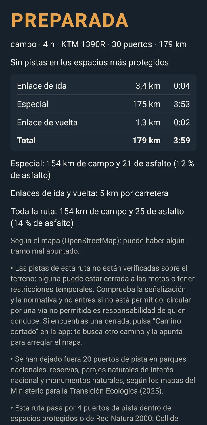
The summary
At the top, what the route gives you: the passes, the points, the km and the riding time, with the category and what you chose (the links, «More off-road», «Always forward», protected areas, range…).
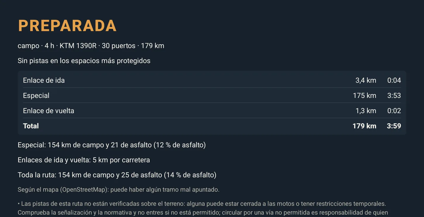
The surface
Off-road and Mixed say how much is on tracks and how much on tarmac, for example: «Whole route: 97 km off-road and 115 on tarmac (54 % tarmac)». Below, the special stage and the links, which go by road. If a route falls short of what its category asks for, it tells you.
The stages
Link out, special stage and link back (on two-day routes, also the link to the night stop), each with its km and time, and the total.
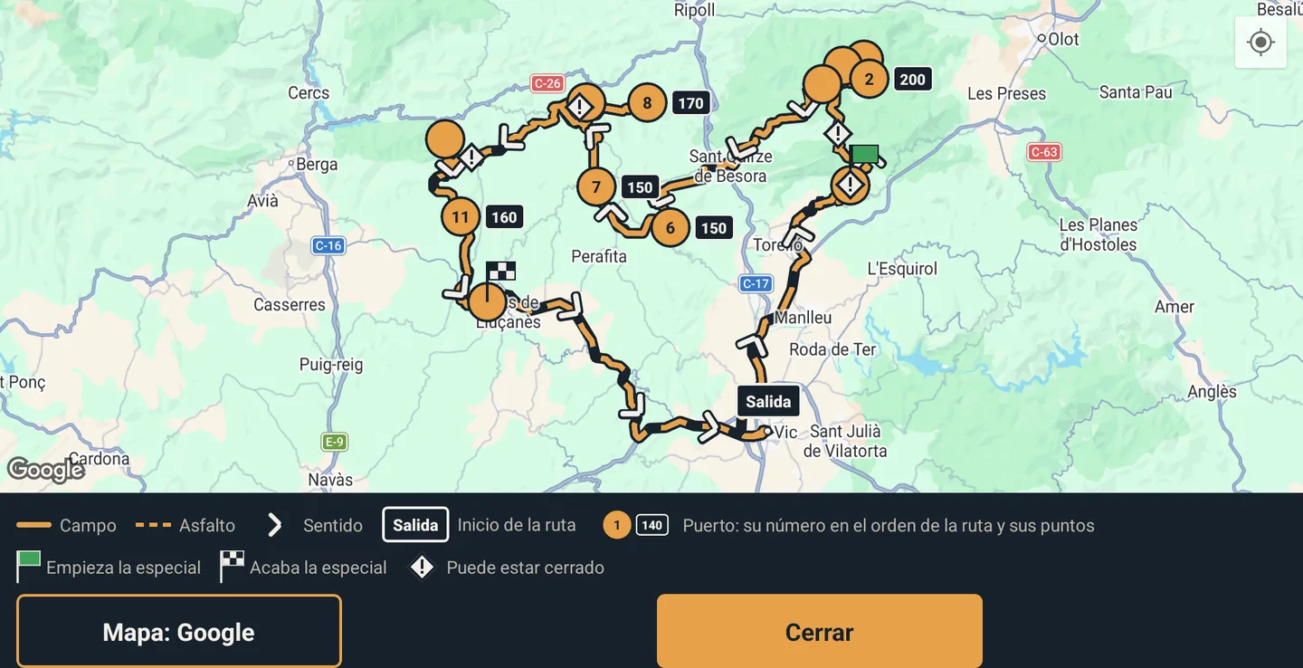
The map
- Every pass, with its number in the order of the route and its points beside it. Tap it: name, municipality, points and time from the start.
- Fuel stations, with their pump. Tap one: brand, town, km, opening hours and time from the start.
- The barriers and closures the map shows, with what the map says about each, promising nothing.
- Off-road and Mixed: tracks as a solid line and tarmac dashed; links dashed; and arrows showing the direction of the route.
- Below, a legend with only what appears on that route.
- Three backgrounds (map, topographic and aerial photo) and full screen.
Start time and arrival
Every pass and fuel station carries its time from the start, including 15-minute fuel stops. If you enter your start time (in the animated route, when sharing the map or in the app), you see when you reach each place and when you arrive.
The GPX and sharing
- «Download GPX»: the route for your GPS (on two-day routes, both days). It can also be emailed.
- «Share the map»: an odinrally.com/r/… link for people without an account, with the map, the stages and the animated route, without the GPX or your account. If the route starts from your location or a point on the map, the first and last kilometre are not shown. You stop sharing it whenever you like.
- «Ride it with another user»: you pass the route to another user to ride it together (see «Riding together»).